11 The Field Log
Everything so far has been about getting the label right, and the label is the part that had to be right. It’s the security, the thing a herbarium has always needed, and now it makes itself. But a system that made only labels would be a tidier version of what we already had. The genuinely new thing, the part that didn’t exist before, is the field log.
For most of this book the field log has been the other product, a row of data for each specimen. That undersells it badly. A row is where a record starts, not where it ends. The field log is the context of the whole collecting event, and because we now capture a coordinate pair for every specimen and can derive a landscape from it, we hold context no field botanist ever had: not a hurried note that says “montane forest,” but the actual shape of the ground, the reach of the canopy, the place in the season, all of it, for nothing.
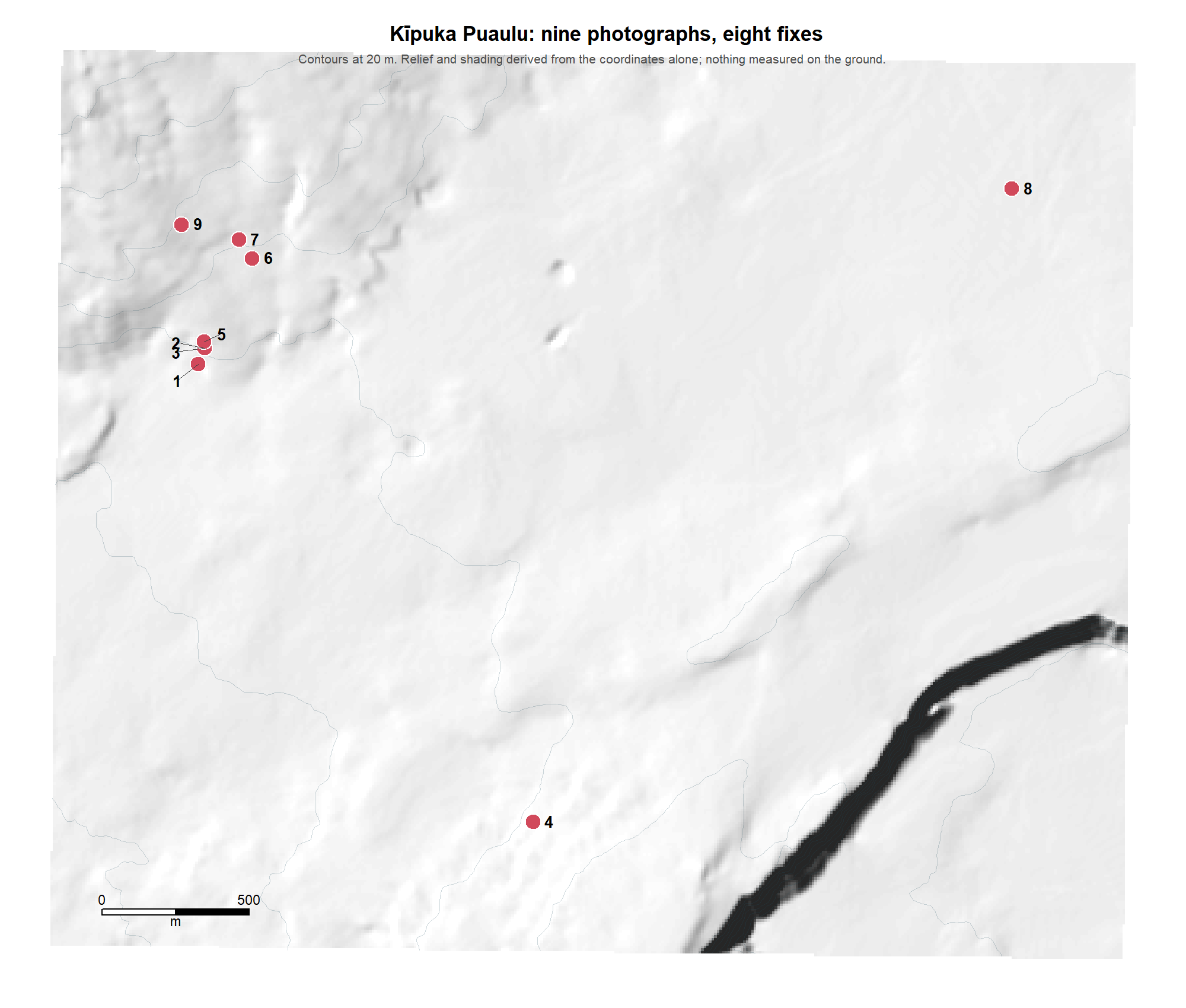
Context like that wants to be seen, not listed. Lay the day’s collections down on the hillshade the coordinates derive, and the collection becomes a picture: here is the ridge you worked, here is the gully you crossed, here is where each specimen actually came from. What a stack of labels can never show, the shape of the whole day’s work on the real ground, a single map shows at a glance.
The map below is not a collection, and the reason it isn’t is worth a sentence. It was made at Kīpuka Puaulu, inside a national park, where nothing may be collected without a permit. I walked it with a camera and no decks, photographing the places where I would have taken a specimen if I had been free to. So there are no specimens behind these points and no collection numbers, and everything else on the map is exactly what a real day would have produced, because every bit of it came from the coordinate in a photograph’s own metadata. Nine photographs, eight distinct fixes, and a landscape.
Then change the scale. Pull back from the slope to the region, and the same points place the work against things a reader already knows: the named peak, the coastline, the road in. A collection is never only where it was. It’s where it was in relation to everything around it, and only a map at more than one scale can say that.
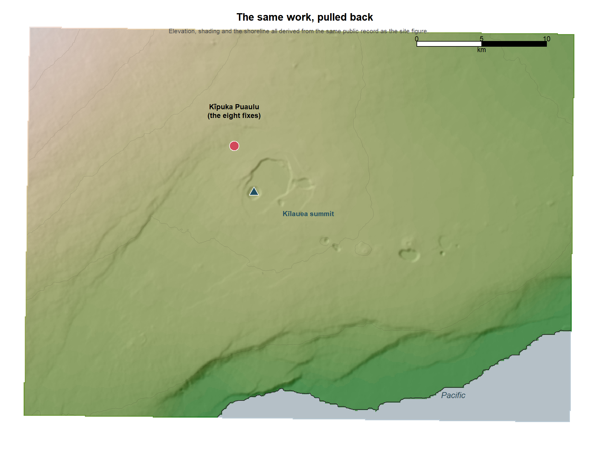
Neither map was drawn. Both were computed, from eight numbers.
A map of where you collected is also, quietly, a map of where you did not, and that turns out to matter more than it sounds. A later researcher looking for a species and not finding it in your records has always faced a hard question: is it truly absent here, or did nobody look? A field log that shows your coverage answers it. “They worked the north slope and never crossed into that valley” is the whole difference between a real absence and an empty space on a map, and it is knowledge the old field notes almost never kept.
Around that spatial core, more can gather, as much or as little as the work wants. The canopy, read straight from the coordinate, gives a physiognomic portrait of the vegetation, its height and closure and structure, with not one species named, the structural half of a habitat description that used to be a rushed sentence if it was written at all. The biome sets the site in the broad pattern of the world’s vegetation. The date, laid against the local seasons and the past year’s weather, fixes it in time as surely as the map fixes it in space. And a scan of each specimen, made as the press closes, ties a picture to every number and quietly guards against a tag that ever works loose. None of these is required. Each is a door.
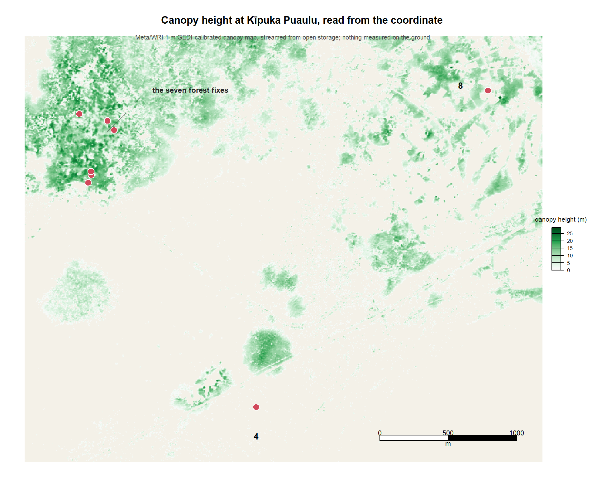
I want to be careful about what that figure is and is not. It is a derived reading: a height for every square metre, from a published product, arrived at without anyone visiting the place. That is its whole virtue, and it is also the reason to distrust it until it has been checked, because a derived value is worth only as much as the check you can put against it. This is the site where I learned that. An earlier and cheaper method — take the surface the treetops make, subtract the bare ground, call the difference the canopy — reported eight metres for this forest, and I knew from having walked in it that it stands closer to twenty. The cheap method had quietly saturated, and only my having been there caught it. The map above puts the tallest stems at twenty-three metres, which is the answer that agrees with the ground.
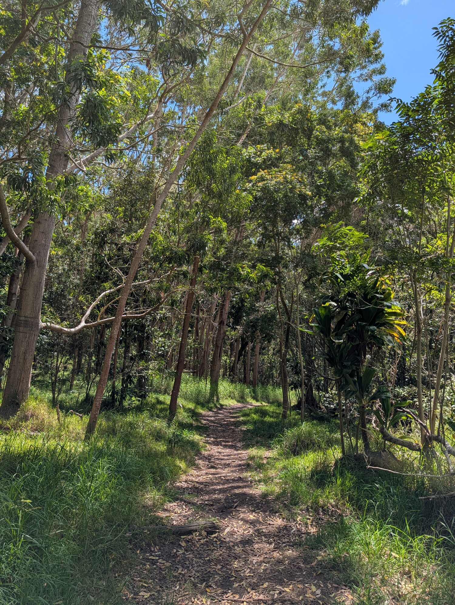
So here is the ground.
I’ve listed what we can do today, not what must be done, and I’ve done it on purpose, because the honest truth is that this is the least of what the field log will become. The tools are new, they will only get better, and the right ones for your flora and your questions are yours to choose, and some of them yours to invent. So the last thing this book does is not to hand you a field log but to ask you for one.
I began in a small room in Sweden, asking how a person respects what was done there. This is the answer I found. You respect a tradition not by keeping it still, but by carrying it forward with the best tools of your own day and handing it on richer than you found it. The collectors before us gave us the sheets and kept them for centuries. We can give those sheets their context back, and give the ones who come after us a record of not only what we found, but where we stood when we found it, and what the world was like around us. The writing table and the cabinet have become a phone and an open map. The habit of mind is the same.
So here, at the end, is the whole of it, handed over. The label takes care of itself now. The field log is open ground, and the tools to work it are, for the first time, in everyone’s hands. What will you make of them?